Laughing Whitefish Falls/ Subway – Alger County
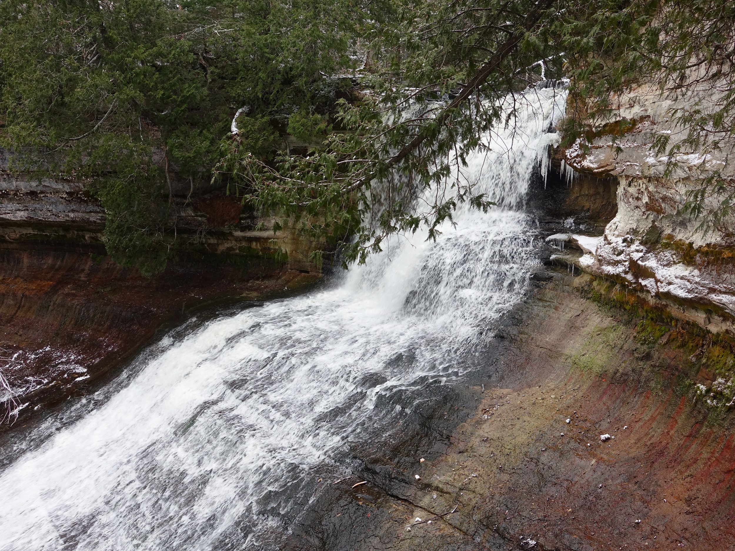
This magnificent cascading waterfall is one of the best in the area and one we highly recommend checking out. The falls cascade through an impressive gorge down exposed rock giving the illusion of a “bridal veil”. For those willing to explore further outside of the main falls area, there is a neat little cave. Called the “subway” by locals, the cave is a tubular exposed sand-stone formation with a small but picturesque waterfall from a nearby creek.
Trail Length:
Laughing Whitefish Falls: 1.2 miles (out and back)
Subway: 2.5 miles (out and back)
North Country Trail Connector (NCT)/ River: 5.5 miles (out and back)
Difficulty:
Easy / Moderate
The walk to the falls is a casual stroll on a pleasant, wide path. You can also view the falls from the bottom of a series of steps which could add to the difficulty. The hike to the subway along the NCT connector can be a little difficult to follow if their is a lot of vegetation but it is otherwise quite flat. Continuing further to the NCT extends the mileage. If you choose to descend down to the river on the NCT there is a sharp decent.
.
Trail Head Directions:
Laughing Whitefish State Park is 28 miles west of Munising along M-94. Drive 7.5 miles west past Chatam and take a right on Co Rd 327. 327 becomes the entrance road to the park into 2 miles.
.
Trail Description:
Main Falls:
To get to the main falls, start at the trailhead near the parking area (P). After about 0.25 miles you will see the NCT connector trail on your left (1). Continue straight for another 0.3 miles to arrive at the top viewing platform (2). To the left of this platform starts the stairs down the gorge to the bottom viewing platform (3).
Subway:
Take a left at (1) on the NCT Connector Trail. After a few hundred yards you will be following an old two track road north. Follow this road for 0.75 miles. At (A) look for the white markers that lead into the woods east. It may be hard to spot. The exact GPS coordinates to the turn off are 46.3935, -87.0713. Follow the white blazes southeast to arrive at the Subway (B) in 0.25 miles.
NCT/ Laughing Whitefish River:
For more adventure, continue north on the NCT Connector Trail for 1.25 miles to reach the North Country Trail junction (C). Heading east (your right), you will descend down the cool gorge to the Laughing Whitefish River. There is a neat footbridge over the river (D).
.
Printable Map and Guide:
Laughing Whitefish Falls and Subway Map and Guide
Laughing Whitefish Falls GPS Track (GPX)
.
Additional Resources:
Laughing Whitefish Falls (Michigan DNR)
.
Pictures:
-

- Top of Subway
-

- Laughing Whitefish Falls
-

- Inside the Subway
-

- Laughing Whitefish River
*Hiawatha Hiking Company provides these maps and resources for free using open source software. Those utilizing these hiking resources do so at their own risk. Any damages due to the use of these resources is not the liability of Hiawatha Hiking Company, LLC