Presque Isle – Marquette Area
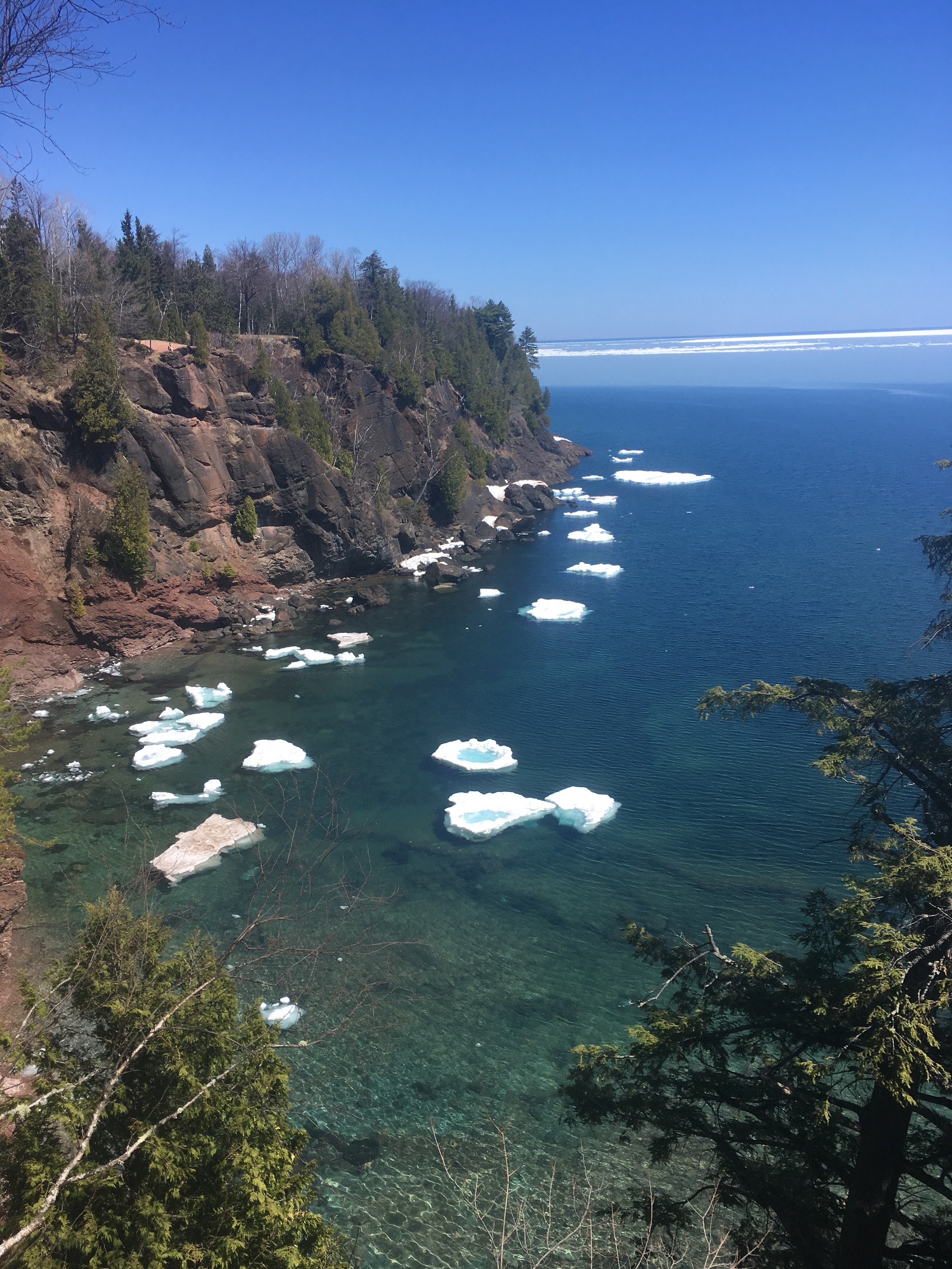
Presque Isle is a scenic oval shaped peninsula situated a few miles north of Marquette. At 323 acres, there are many sights to behold including beaches, cliffs, and beautiful interior woodland home to more than 100 species of native plants. Presque Isle is best known for its northern most point which is called Black Rocks. It is a popular destination for impressive rocky coastal views and a great location for cliff jumping into Lake Superior during the summer months.
Trail Length:
2.4 mile loop (1-2 hours)
Difficulty:
Easy
The trails that circumnavigate Presque Isle are relatively flat and easy to walk. There is a minor hill at the beginning which is 90 ft over 0.2 miles. In the summer cars are allowed on Peter White Road which circumnavigates the park. You can drive to the small parking area mentioned at location (3) in the directions below which has closer access to Blackrocks.
.
Trail Head Directions:
Presque Isle Park is 3.5 miles north of downtown Marquette. Travel north on Lakeshore Boulevard until the road ends at the park. Directions for this hike start at the eastern most parking area which is near the Presque Isle Gazebo. Bear right at the entrance to the park and drive a little ways to find the gazebo and parking location.
.
Trail Description:
Start the hike (P) by walking on Peter White road up the small hill. Once you are up on the escarpment, you can head off the road towards Lake Superior and there will be a parallel walking path. Fallow this path until you arrive at a picturesque overlook platform (1). Continue following the path until it rejoins with Peter White Road. In a few hundred feet the walking path will be visible again along the lakeshore. Follow this path away from the road and continue to location (2) where it ends. Take the path to the left to rejoin with Peter White Road. Continue following the road north down a hill (3). At the bottom of the hill to your right you will see a small parking area. Walk towards the parking area and keep to the left of the large inlet in front of you, this will lead you to the rocky shoreline. Walk out onto the rocky slabs for views of Blackrocks (4). In the summer you will often see brave souls jumping off the cliffs into the small inlet. Retrace back to (3) and continue along Peter White Road. Past signed Sunset Point you can choose to continue to walk on the road or the path that parallels it along the shoreline. Looking west from this location you will see Middle Island, Partridge Island beyond, and the peaks of Sugarloaf Mountain and Hogback Mountain. At point (5) you will encounter the west parking area and beach. Continue south on the road and then bear left at the entrance to the park to make your way back to where you parked.
.
Printable Map and Guide:
.
Additional Resources:
Presque Isle Information from the City of Marquette
.
Pictures:


*Hiawatha Hiking Company provides these maps and resources for free using open source software. Those utilizing these hiking resources do so at their own risk. Any damages due to the use of these resources is not the liability of Hiawatha Hiking Company, LLC