Mount Marquette – Marquette Area
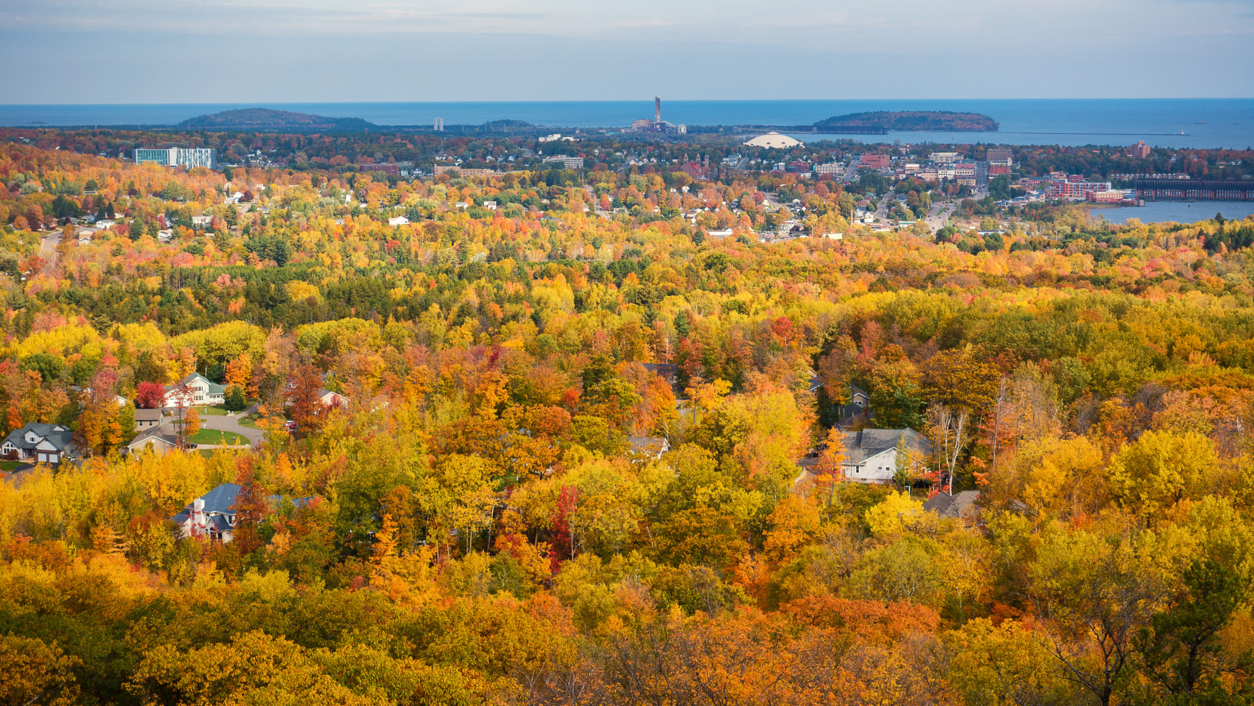
Mount Marquette is a great little hike that will take you to an amazing overlook of the city of Marquette and Lake Superior beyond. Originally called Mount Mesnard after the French Jesuit Missionary, Rene Mesnard, and later named Mount Marquette in the 1960s after the explorer Jacques Marquette, this 1,106 ft. peak near the shores of Lake Superior offers an amazing hike right near the city, winding its way to the overlook through beautiful mixed pine and hardwood forests. For those into history, the Beaumier UP Heritage Center has an exhibit that highlights the peaks unique mining history.
Trail Length:
3 mile loop (1-2 hours)
Difficulty:
Moderate
The trail is easy to navigate; however, the trail tread is a range of packed dirt to uneven trail surface with rocks and roots. After the 1 mile mark from the parking area there is about a 400 ft climb to the overlook over 3/4 of a mile.
.
Trail Head Directions:
Head south on US-41 out of Marquette and take a right on Cliff Power Rd right before your cross over the Carp River. There is a large apartment complex right near the road entrance. Follow this road for a half mile and there is a small parking area on your right at the beginning of Mount Marquette Road.
.
Trail Description:
This hike is part of the South Trails of the Noquemanon Trail Network (NTN). There are many trails in this area so be aware of which one you are on. The Mount Marquette loop has blue markings and this is what you will primarily follow.
Start from the trailhead (P) and begin your hike north on the single track trail . You will pass a small creek and eventually start climbing at the 1-mile mark. You will reach a trail juncture at location (1) and a small neighborhood will be on your right just beyond the woods . Keep left at this juncture to continue on the blue trail. You will continue to climb up until you finally reach a small sign that will say Mount Marquette and a direction arrow (2). Bear left at this sign and continue hiking up a few switchbacks. You will eventually pop out on Mount Marquette Road (3). Take a right and continue up the road. In a few hundred feet you will reach the overlook (4).
To head back, continue down along Mount Marquette Road. In about 1/4 of a mile look for a trail on your left (5). Follow the trail until you cross the road again in about 1 mile. You will see the parking area down the road to your right.
Celebrate your accomplishment with a tasty Reclamation IPA at Ore Dock Brewing Company in downtown Marquette!
.
Printable Map and Guide:
Mount Marquette GPS File (GPX)
.
Additional Resources:
Noquemanon Trail Network (NTN)
.
Pictures:

Looking out to Marquette from the overlook
*Hiawatha Hiking Company provides these maps and resources for free using open source software. Those utilizing these hiking resources do so at their own risk. Any damages due to the use of these resources is not the liability of Hiawatha Hiking Company, LLC