Bulldog Falls/ West Branch Yellow Dog Falls – McCormick Wilderness
The majestic and quiet McCormick Wilderness Area in the Ottawa National Forest is one of those places you need to put in a little extra work to reap its rewards. Situated an hours drive North West of Marquette, this hike takes you into the North East quadrant of the McCormick which is home to two very special waterfalls, the West Branch of the Yellow Dog Falls and Bulldog Falls. You will likely not see many (if any) people here, and may even spot a Moose if you’re lucky!
Trail Length:
5.5 miles out and back (2-3 hours)
Difficulty:
Moderate/ Challenging
The trail is mostly easy to follow but there are no trail markings in the Wilderness area. You may have to ford the West Branch of the Yellow Dog River. A portion of this route leading up to Bulldog Falls is only marked by sporadic blue ribbon (as of Fall 2020) and could be considered “off-trail” walking. This section also has portions of rock scramble and should be done with caution. Please bring a GPS device and/or map and compass (and know how to use them).
.
Trail Head Directions:
It takes about an hour to drive out to the trailhead from Marquette center. Drive 23 miles west on Big Bay Road (550) out of Marquette. Take a left on 510 heading to the Eagle Mine and follow for 2.5 miles. Keep straight on AAA road. Once you pass the Eagle Mine, continue straight onto a dirt road. At this point, I would recommend you just follow Google to the trailhead as it is somewhat of a confusing network of dirt roads for 4-5 miles. There is space for a few cars at the trailhead. I would recommend a vehicle with some clearance to safely get there.
.
Trail Description:
Start from the trailhead (P) and follow the unmarked trail for 1.1 miles until you reach the West Branch of the Yellow Dog river (1). Take a right (south) and walk about 500 feet for a view of the first falls (2). Retrace your steps and cross over the river (1), you may have to take off your shoes or get them wet. Continue for another 2/3rds of a mile until you run out of trail at (3) and you see a river in front and blue ribbons leading to the south (to your right). Follow the blue ribbons along the west bank of the river for about 1/2 a mile. At this point you should start seeing some of the lower cascading falls. You can keep going up-river to more and more waterfalls, each seemingly more impressive than the last. Caution: some spots are tricky to navigate past so watch your footing. Point (4) on the map is the last of the big falls. Take a break and then retrace your steps back to the trailhead.
.
Printable Map and Guide:
.
Additional Resources:
National Forest Service Map of McCormick Wilderness
.
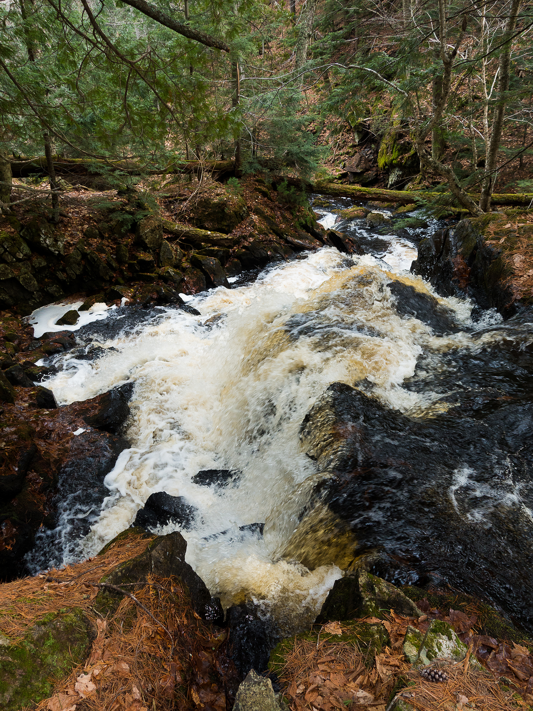
Pictures:
-

- West Branch of Yellow Dog Falls (2)
-

- One of several falls on the way up to (4)
-

- Top of Bulldog Falls (4)
*Hiawatha Hiking Company provides these maps and resources for free using open source software. Those utilizing these hiking resources do so at their own risk. Any damages due to the use of these resources is not the liability of Hiawatha Hiking Company, LLC