Hogback Mountain – Marquette Area
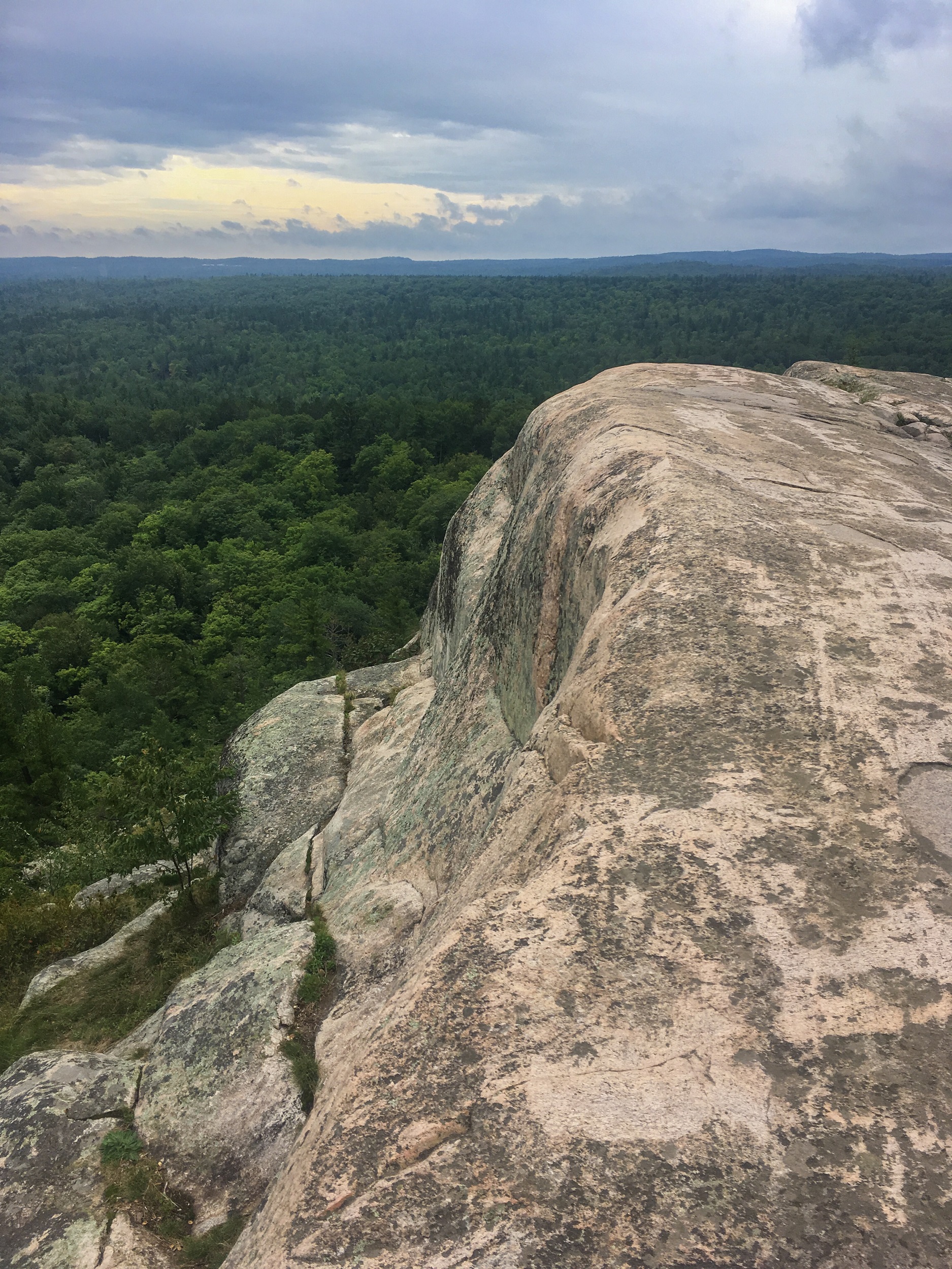
Hogback Mountain (referred by locals simply as Hogsback), is a challenging hike to a remote peak in the southern portion of the Huron Mountains. The 1,220 ft peak is absent of vegetation and exhibits granite slab outcroppings rewarding the strong hiker with 360 degrees of unobstructed views of Lake Superior to the east and endless stretches of undeveloped forest and hills to the north and west. It’s one of the best views in the UP!
Trail Length:
3.5 miles out and back (2 – 4 hours)
Difficulty:
Challenging
Hogsback is a difficult hike. There is a total elevation gain of 785 ft, with 545 ft gained in the last 0.75 miles. The last 0.25 miles to the summit is especially difficult with some minor rock scrambling involved, with slick rock surfaces possible if they are wet.
.
Trail Head Directions:
The trailhead is about 7 miles from Marquette center. Head north on 550 towards Big Bay for about 4.5 miles from the intersection of Big Bay Rd and Sugar Loaf Ave. You will see a dirt road on your left leading to a large parking area. The road access to parking is opposite of the Wetmore Landing Trailhead Parking area.
.
Trail Description:
The trail starts at the back (western) end of the parking area (P). In about a hundred yards you will cross a large dirt two-track path (1). Cross the path and then bear right. A marker with Hogsback listed on it will be visible as you continue into the woods. At the 1 mile mark you will cross an old railroad grade and a small foot bridge (2). In 0.1 miles you will encounter an intersection (3) – bear left here. In another 0.1 miles you will encounter another intersection (4) – bear right and follow the white blazes on the trees – this is a reroute of the trail. This is the point where the trail starts to ascend rapidly. In another 0.35 miles you will encounter the final intersection (5) – bear left towards the summit. Ascend the final 0.25 miles over steep rocks to reach the summit (6). Retrace your steps back to the parking area.
Celebrate your awesome achievement with a 51K IPA from Blackrocks Brewery in downtown Marquette.
.
Printable Map and Guide:
Hogback Mountain Map and Guide
Hogback Mountain GPS File (GPX)
.
Pictures:
*Hiawatha Hiking Company provides these maps and resources for free using open source software. Those utilizing these hiking resources do so at their own risk. Any damages due to the use of these resources is not the liability of Hiawatha Hiking Company, LLC


